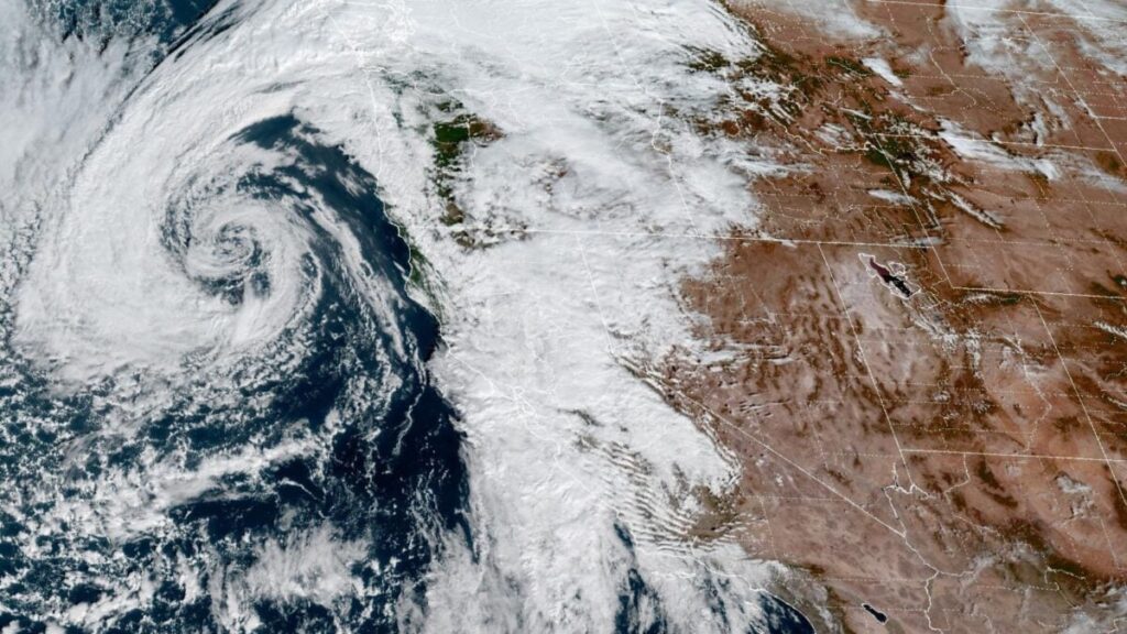
California’s historic wildfire season may come to an early end this week as an atmospheric river drenches the state, but the much-needed rain is bringing new hazards.
The storm arrived in California on Wednesday. Forecasters at the National Weather Service’s Los Angeles office expect it to intensify on Thursday night and Saturday, warning of “periods of moderate to heavy rain” during these times. By Friday, 1 to 2 inches (2.5 to 5.1 centimeters) of rain could fall across Los Angeles, Ventura, Santa Barbara, and San Luis Obispo counties. Higher rainfall totals of 2 to 4 in (5.1 to 10.2 cm) are possible in the mountains and foothills.
That said, there’s a lot of uncertainty around the current forecast. Meteorologists expect the atmospheric river to move quickly across Northern California, but models suggest it could stall over Southern California, potentially delivering more rain than earlier forecasts predicted.
Officials are urging residents of burn-scarred Los Angeles to evacuate as the deluge creates a risk of flash flooding and mudslides. The warning will remain in effect from 6 p.m. ET Thursday to 11 a.m. PT Sunday.
How wildfire makes rain more dangerous
California’s wildfire season got off to an exceptionally early start this year when multiple blazes tore through the Los Angeles area in January. Throughout the spring, summer, and fall, drought conditions continued to fuel fires across the state.
The intense heat from wildfires bakes the landscape, leaving behind burn scars that can be as water repellent as pavement, according to the NWS. As plants burn, they release a waxy substance that solidifies on the top layer of soil, causing it to become hydrophobic. Loss of plants also destabilizes the soil and makes it easier for rainwater to reach the ground.
It therefore takes far less rainfall to trigger a flash flood or mudslide in a burn scar. That’s why officials are urging Los Angeles residents to evacuate ahead of this storm.
A potential end to the 2025 fire season
Atmospheric rivers are long, narrow regions in the atmosphere that transport most of the water vapor outside the tropics. Though they vary widely in size and strength, the average atmospheric river carries as much water as the average flow at the mouth of the Mississippi River, according to NOAA.
When these plumes of moisture make landfall, they often dump their water vapor in the form of heavy rain or snow. That’s what’s happening in California this week. Though nearly the entire state will receive precipitation, forecasters expect Southern California to face the brunt of the storm’s impact.
That said, there is a silver lining. “If we do end up getting the rainfall that we expect, this will certainly get us close to the end of the fire season,” Ryan Kittell, a meteorologist with the NWS office in Oxnard, told the Los Angeles Times.
Thanks to climate change, experts now consider California’s wildfire season a year-round phenomenon, as L.A.’s January wildfires clearly demonstrated. That disaster was preceded by a record-long dry spell that gripped Southern California from fall 2024 through the start of 2025.
This November storm could significantly reduce fire risk across California, helping to prevent another winter disaster. “There’s been studies done at Scripps Institution of Oceanography that looked at how much rain is needed in the Southern California region to really mitigate wildfire risk and it showed that it was about a third of an inch over three days,” Julia Kalansky, a Scripps climatologist, told KPBS.
The outcome of this storm remains to be seen, but it certainly underscores how interconnected California’s extreme weather hazards have become. The best-case scenario is a marked reduction in wildfire risk with minimal flooding, landslides, and infrastructure damage.

